
This screenshot shows the whole world. Here, you can see my choice to highlight the natural landscape, using land cover and bathymetry, over political boundaries and labels. One doesn’t need labels or boundaries to appreciate the patterns of the natural landscape.
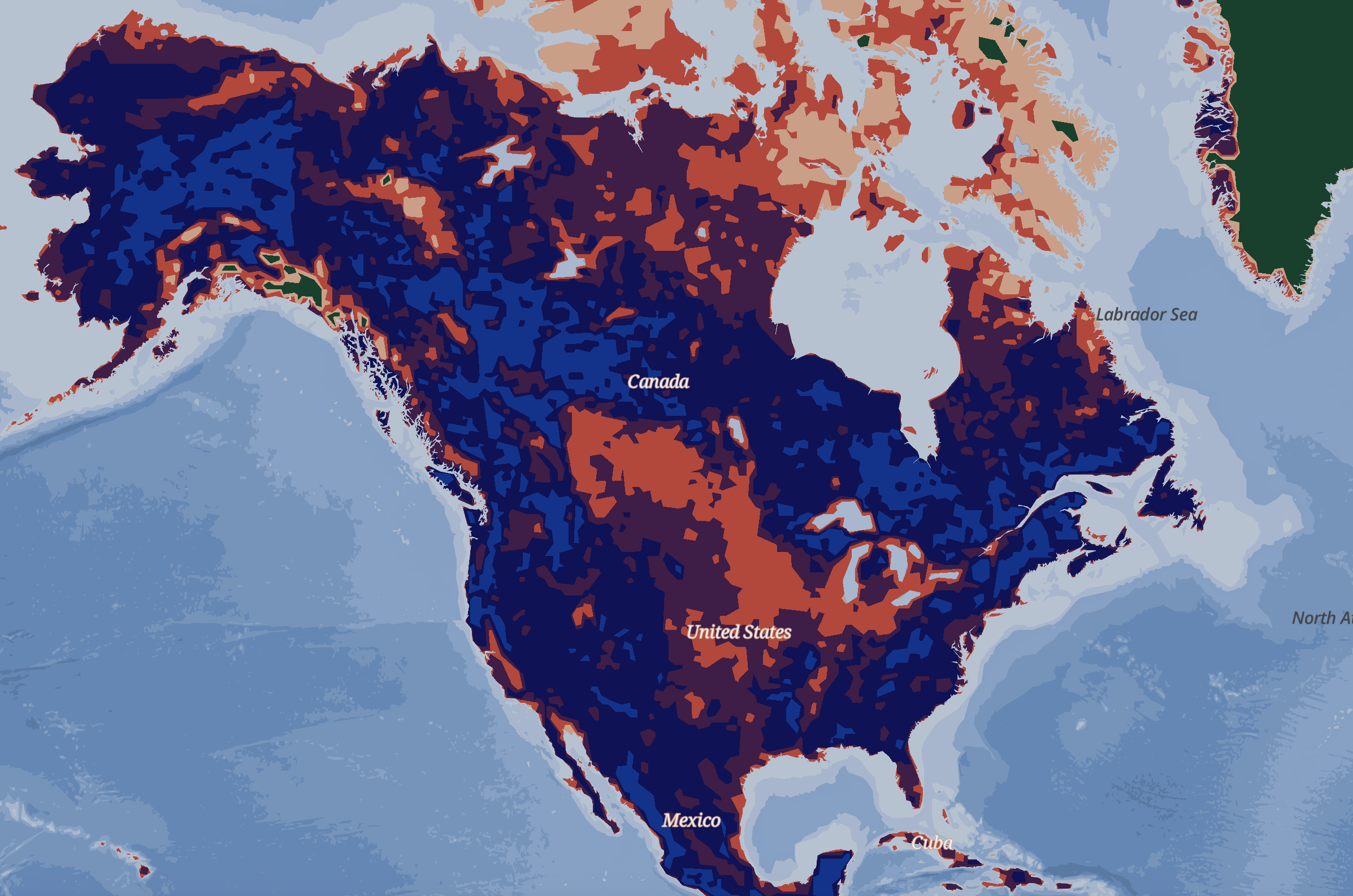
This shows North American continent at a similar zoom level to Asia and South America with landcover and bathymetry polygons. I chose to have dark natural labels, i.e. Labrador Sea, so they would show up well on all shades of the water.
This shows the west coast of Africa. Bassau, the capital city of Guinea-Bissau, is visualized as a point feature with a larger rose, while the province and regional capitals are as smaller roses. I chose to abstract cities as a nod to O’Keeffe’s famous flower paintings and another method of directing focus to the natural landscape at higher zoom levels.
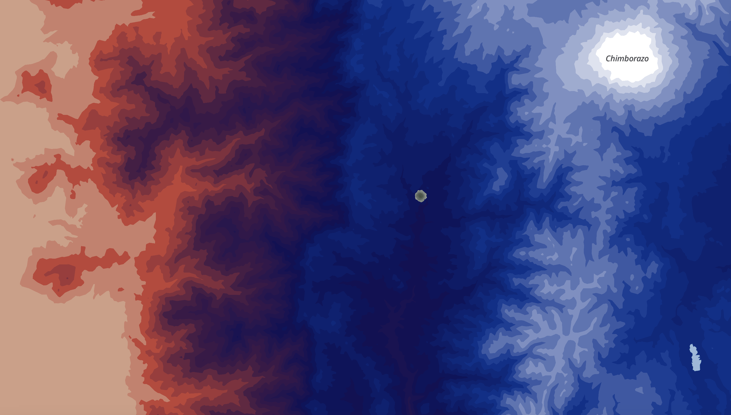
This screenshot shows Chimborazo, an inactive volcano and the highest mountain in Ecuador. The plateaus of elevation change in this area remind me of the distinct levels of mountains O’Keeffe painted in Black Mesa Landscapes. In this screenshot, one can also see how the dark natural label colors are clearly visible on the tops of mountains.
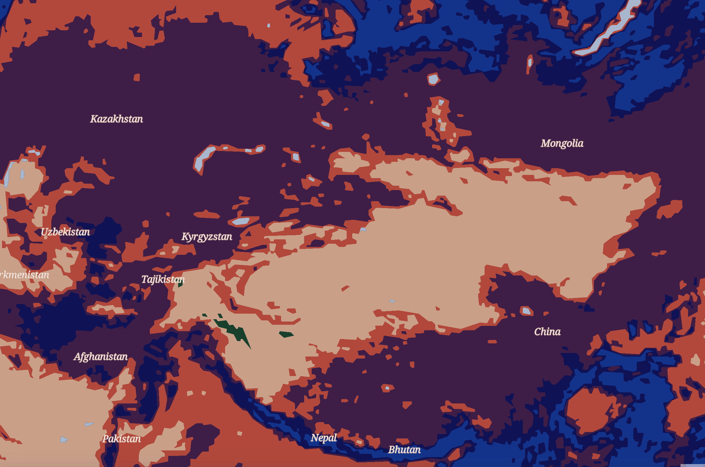
Here, you can see central Asia. On zooming in, country names appear, so there are some reference points for the map user, but no borders, allowing the land cover patterns to be the focus of this map. For the other land cover category, which encompasses desert and hard-to-reach places, I chose the light peach color, which evokes sandy, dry places.
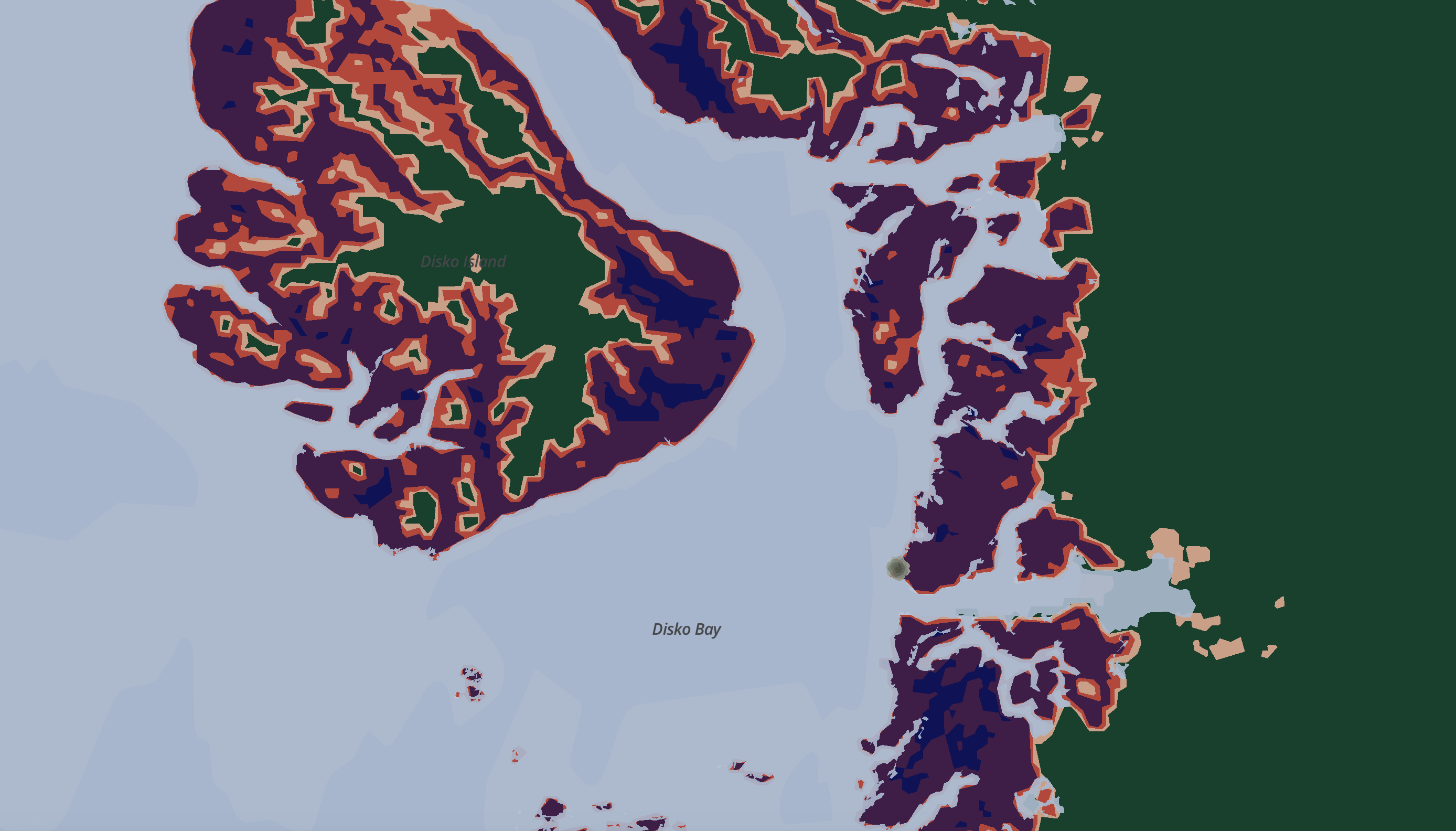
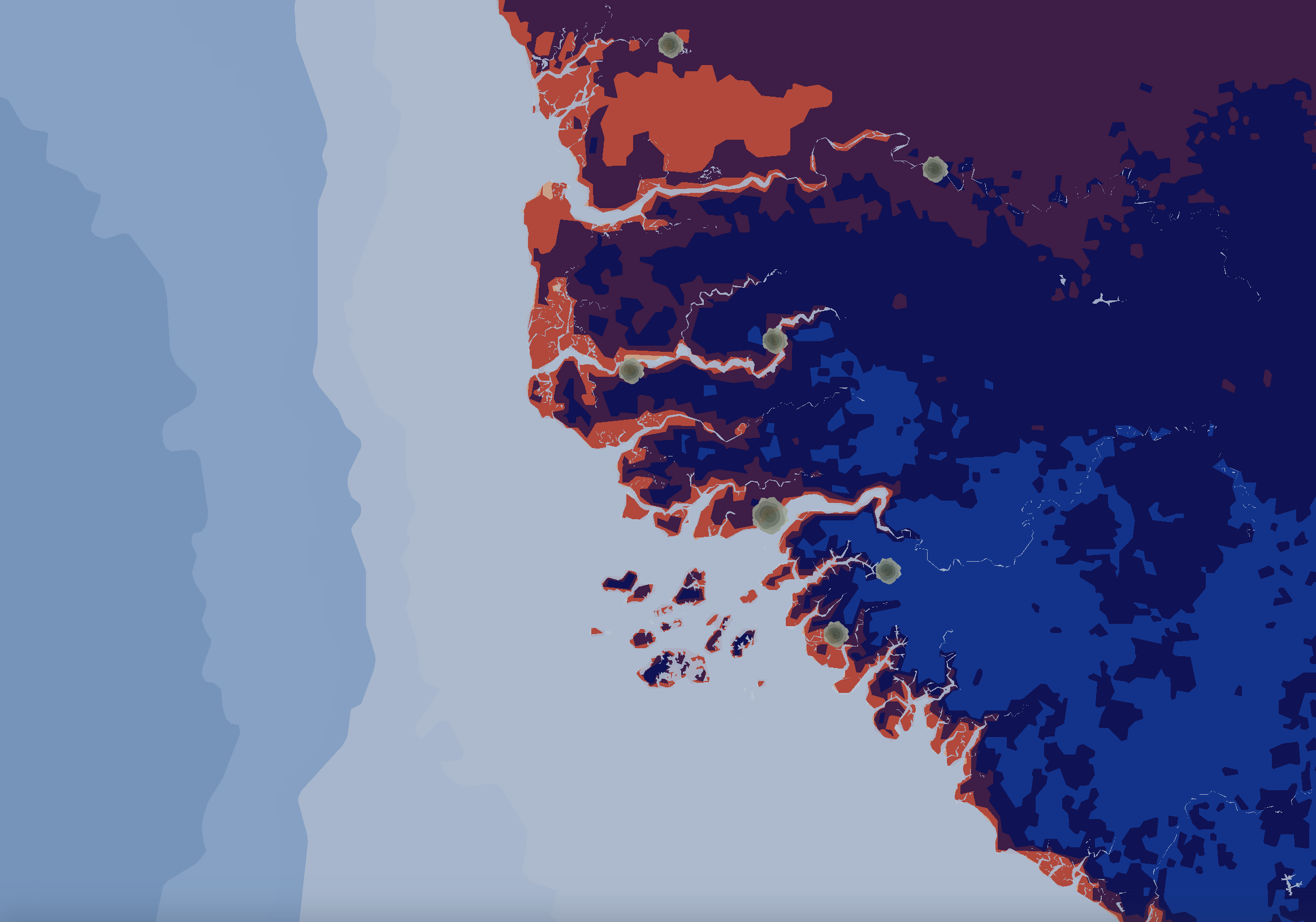
This screenshot shows the western shore of Greenland. Landcover colors were chosen from Black Mesa Landscape, New Mexico / Out Back of Marie’s II, 1930. The landcover types were assigned colors that would best replicate the top-to-bottom order of the colors used by O’Keeffe based on the most common order of landcover types across a range of locations and zoom levels.

Here are the Northeastern, Mid-Atlantic, and Midwestern states of the United States. At this higher zoom-level, country names disappear, and state or province labels appear. Like the country political units, the states have labels so the user can find their location, but no outlines, because the emphasis is on the flowing natural landscape.
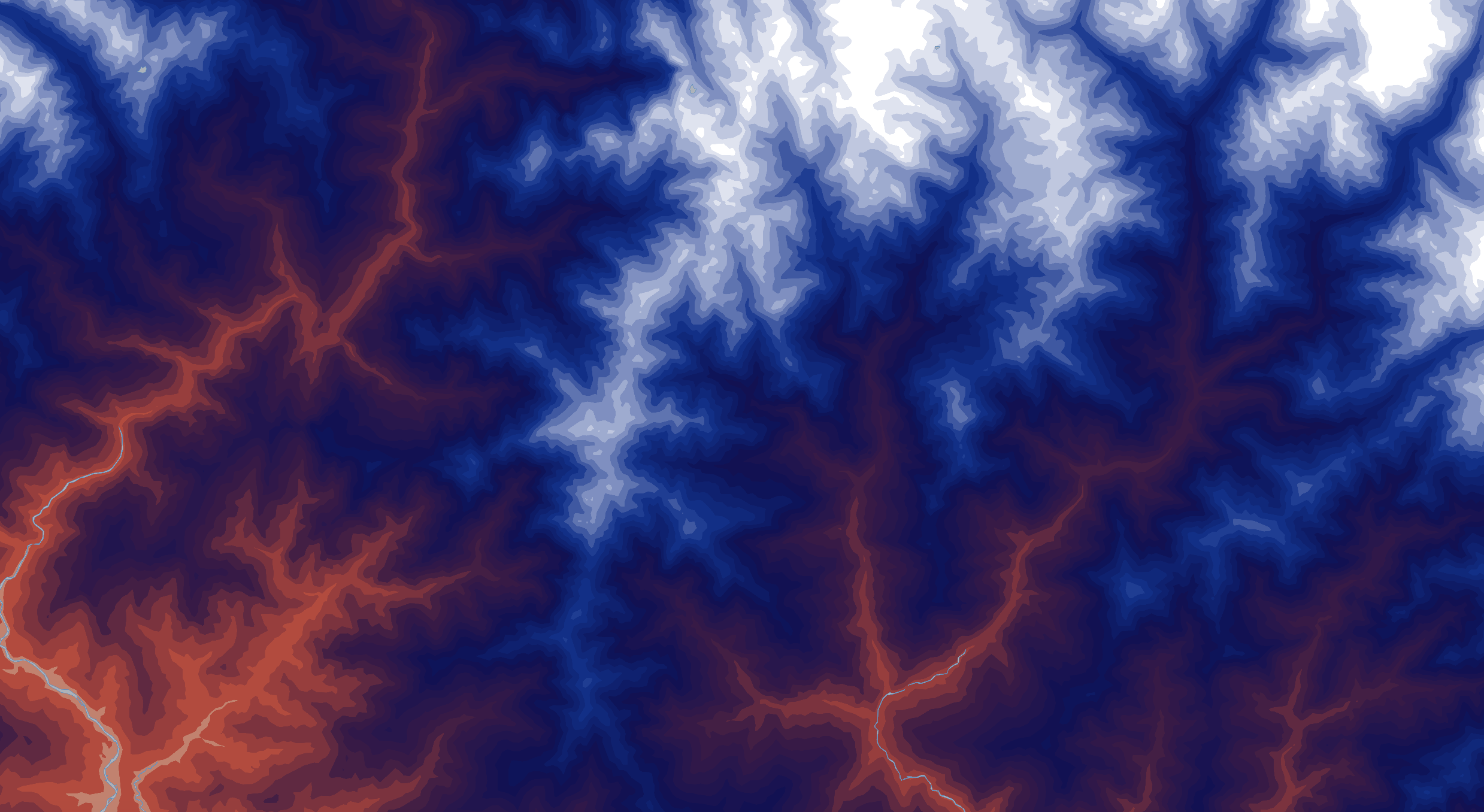
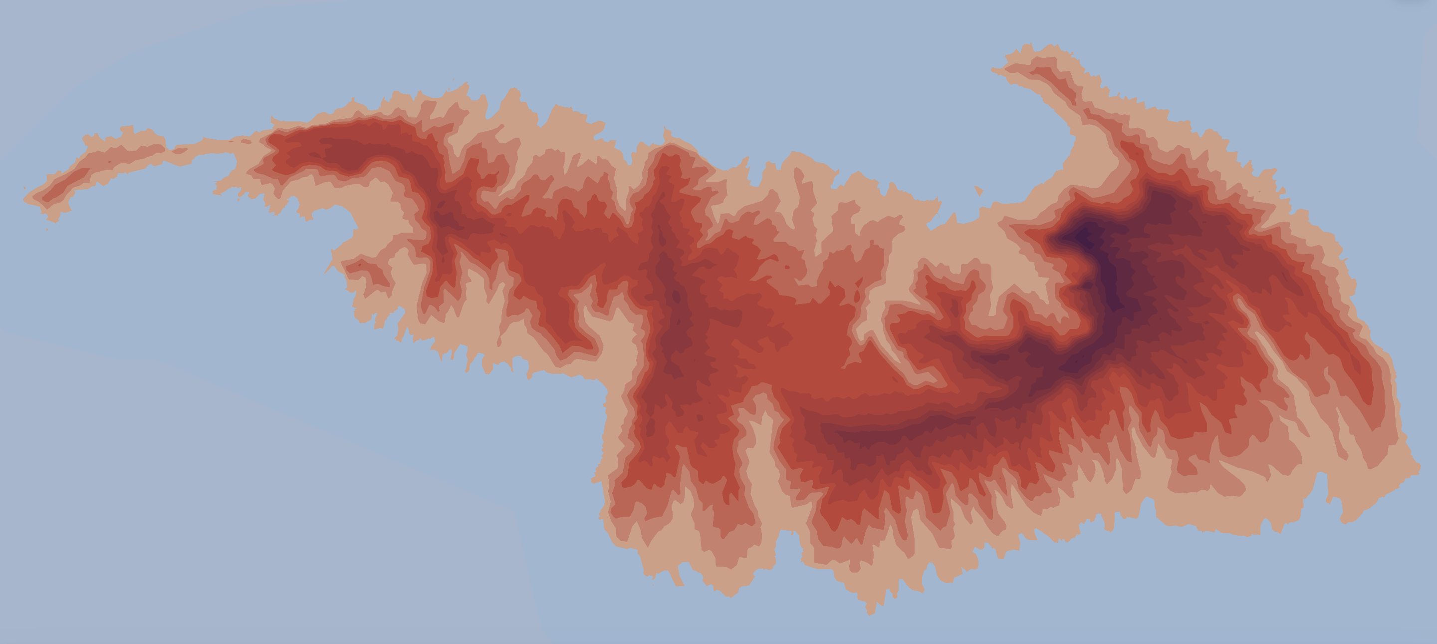
This screenshot shows the southern edge of the Himalayas. The dramatic elevation changes here offer a gorgeous gradient from white to navy to purple to peach, showing how well the colors O’Keeffe used in Black Mesa Landscape work together. The topography data enables gradual transitions, which are difficult to replicate in coarse data divided up into few categories, like the land cover data, and also accentuates natural features like river valleys, which are prominent in O’Keeffe’s work.
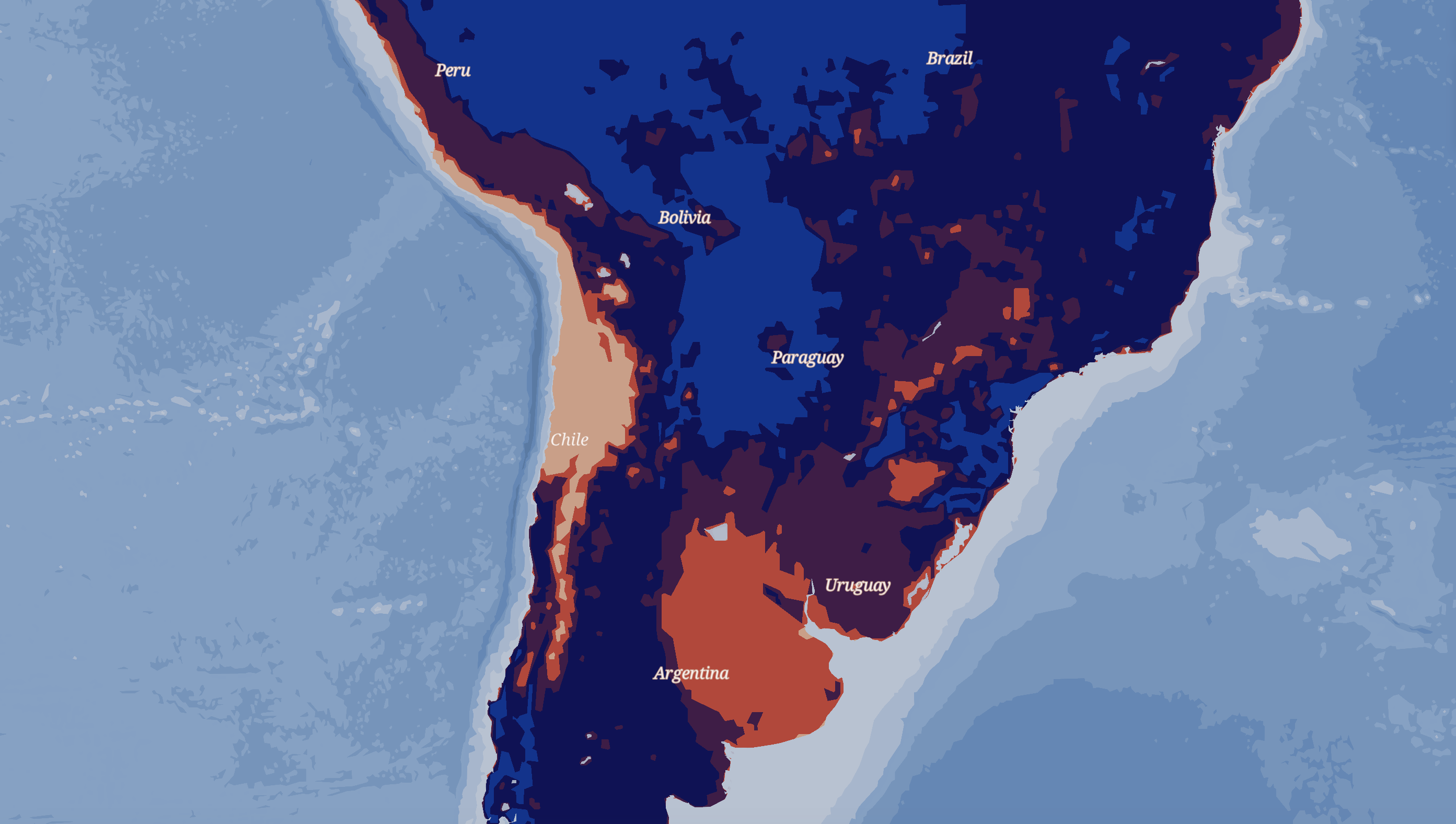
This screenshot zooms in on central South America and the surrounding oceans to a similar level to the central Asia screenshot. Here you can see that I used bathymetry layers to create texture and the fade from one color shade to another that is so characteristic of Georgia O’Keeffe. The blues were chosen from Chama River, Ghost Ranch, 1937.

This shows southeastern Europe. At this zoom level, there are no labels for countries anymore, but natural features are still named. This encourages the map users to orient themselves using the names of water bodies and mountains and the shapes of landmasses rather than the names of countries or cities.
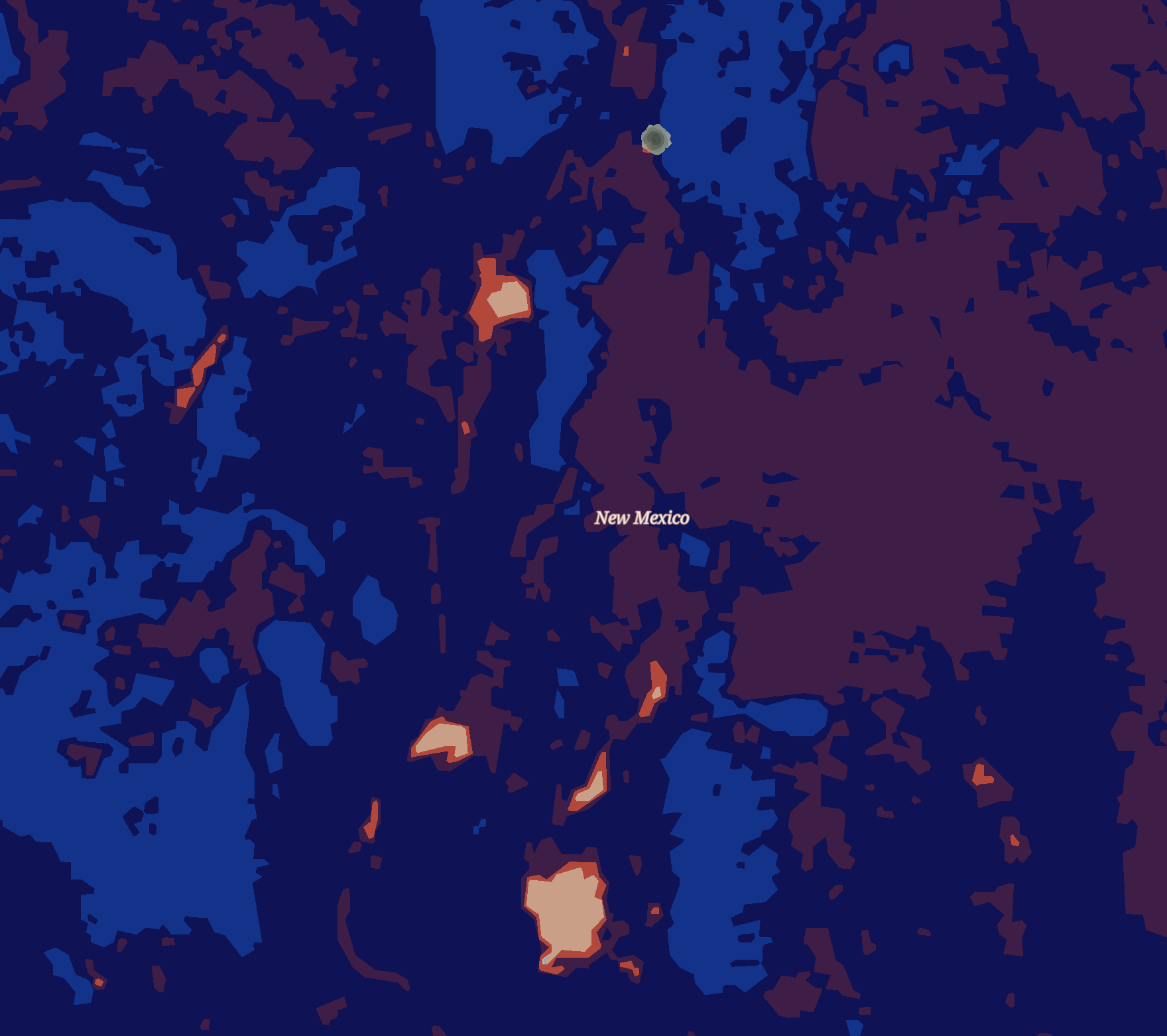
This screenshot highlights New Mexico. Many of Georgia O’Keeffe’s landscapes were painted here. The landcover colors also follow the order of the colors in Black Mesa at a higher zoom level. Because there are few places of the world that have the green landscape category (ice), the rosettes representing region/state capitols are also green, so that the gray-green colors in Black Mesa Landscape are also represented in my map.
Here is an unnamed volcanic island in the Pacific Ocean. In places with a less dramatic elevation change than Chimborazo or the Himalayas, the colors fade more gradually into each other, focusing in on the colors used in different subsections of her painting – in this case the foothills in foreground of Black Mesa Landscape.